Animal Trail and Walkways - (view photos)
A travel way for livestock and/or wildlife to provide movement through difficult
or sensitive terrain. The trails should accomplish one or more of the following
purposes: provide or improve access to forage, water and/or shelter; improve grazing
efficiency and distribution, divert travel away from ecologically sensitive and/or
erosive sites.
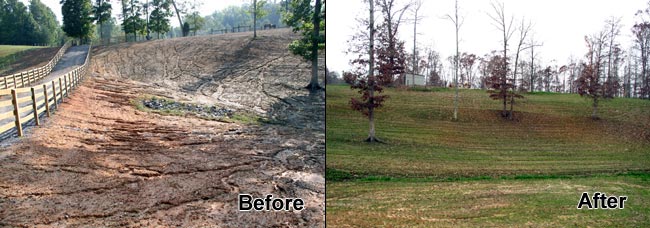
Critical Area Planting - (view photos)
Establish permanent vegetation on areas with existing or expected high rates of
erosion on degraded sites that usually cannot be stabilized by ordinary conservation
treatment, and if left untreated could be severely damaged by erosion.
Cropland Conversion
Establish and maintain a conservation cover of grasses, trees, or wildlife plantings
on fields previously used for crop production to improve water quality.
Fence
Enclosing or dividing an area of land with a suitable permanent structure to: exclude
livestock or big game from areas that should be protected from grazing; control
domestic livestock while permitting wildlife movement; confine livestock or big
game to an area.
Field Border
A strip of permanent vegetation established at the edge of a field to: control erosion,
protect edges of fields that are used as turn rows or travel lanes for farm machinery,
reduce competition from adjacent woodland, provide wildlife food cover, or improve
the landscape.
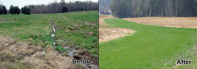
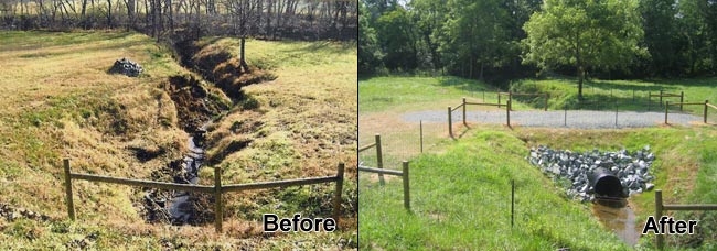
Grassed Waterway - (view photos)
A natural or constructed channel that is shaped or graded to required dimensions
for the purpose of: conveying runoff from rows, terraces, diversions or other water
concentrations without causing erosion or flooding; to reduce gully erosion and
to protect water quality.
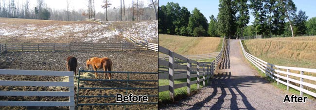
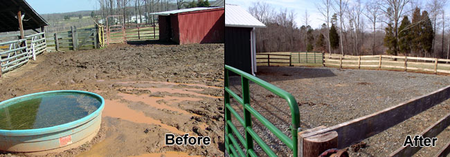
Heavy Use Protection - (view photos)
The stabilization of areas frequently and intensively used by people, animals or
vehicles by establishing vegetative cover, by surfacing with suitable materials
and/or by installing needed structures.
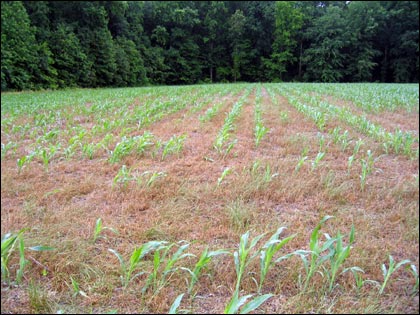
Long Term No-Till - (view photo)
Planting all crops for at least five consecutive years in 80% or more residue from
the existing crops and/or cover crops with no soil surface width disturbance greater
than 25% of the row spacing.
Stream Crossing - (view photos)
A trail or travel-way constructed across a stream to allow livestock or equipment
to cross without disturbing the bottom or causing erosion on the banks.
Stripcropping - (view photos)
Growing crops and sod in systematic arrangement of alternating strips or bands on
the contour to improve water quality.
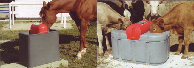
Watering Facility - (view photos)
A device (tank, trough or other watertight container) for providing animal access
to water in order to: protect and enhance vegetative cover through proper distribution
of grazing; provide erosion control through better grassland management and/or protect
streams, ponds and water supplies from contamination by providing alternative access
to water.
This is only a partial listing of conservation practices. For a complete list of practices or questions regarding our Conservation Programs, please call 703-2850, or come by the Forsyth Soil and Water Conservation District, 1450 Fairchild Road, Winston-Salem (located near the Smith-Reynolds Airport in the Agriculture Building).


